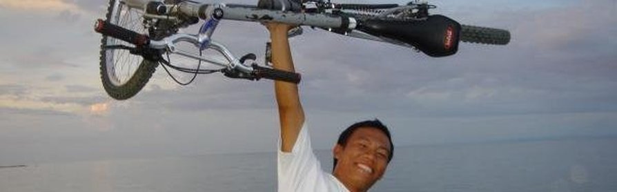
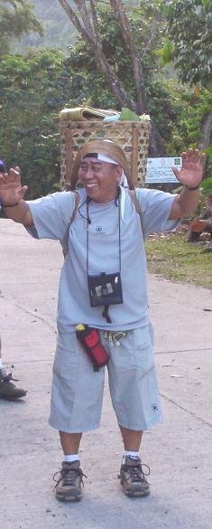
Hi there, welcome to this page, I'm a very dynamic person, am into everything. Designs, photography, Artistry, Painting, Sales and Marketing, Outdoor Adventure, Events Coordinating, Orienteering and making new friends especially. Chill and relax to music and the net (facebook - [email protected] add me)
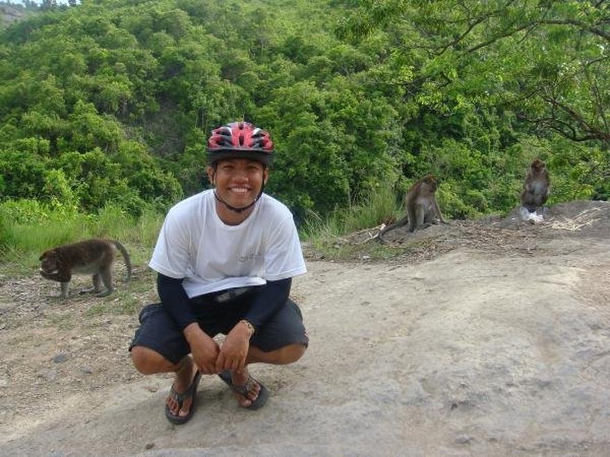
Paitan, Monkey Sanctuary in Sitio Palinpinon, Barangay Pagumayon is home of hundreds of wild monkeys. These monkeys are people-friendly but very territorial in nature. They thrived on the food brought by visitors and tourists. The most dominant are pregnant monkeys of their kind.
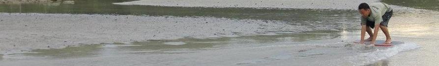
Skimboarding s a boardsport in which a skimboard (a smaller counterpart to a surfboard without fins) is used to glide across the water's surface. Unlike surfing, skimboarding begins on the beach by dropping the board onto the thin wash of previous waves. Skimboarders use their momentum to skim out to breaking waves, which they then catch back into shore in a manner similar to surfing. Another aspect of skimboarding is 'flatland', which involves performing tricks derived from skateboarding such as ollies and shove-its on the wash of waves without catching shore breaks.
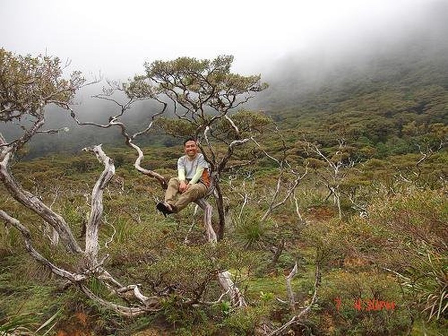
BAKTAS SA KINAIYAHAN... mountaineering
MT. KANLAON (WASAY-MASULOG MANANAWIN TRAIL)
Negros Occidental Buddies:
Entry point: Brgy. Mambucal, Murcia, Negros Occ. Noli "Nukos" Sarita
Exit point: Masulog, Mananawin, Canlaon City, Negros Oriental Neil "Tanelz" Batohanon
LLA: 10°24'44"N, 123°7'55"E, 2435 MASL (#27) Walter "Wali" Caunca
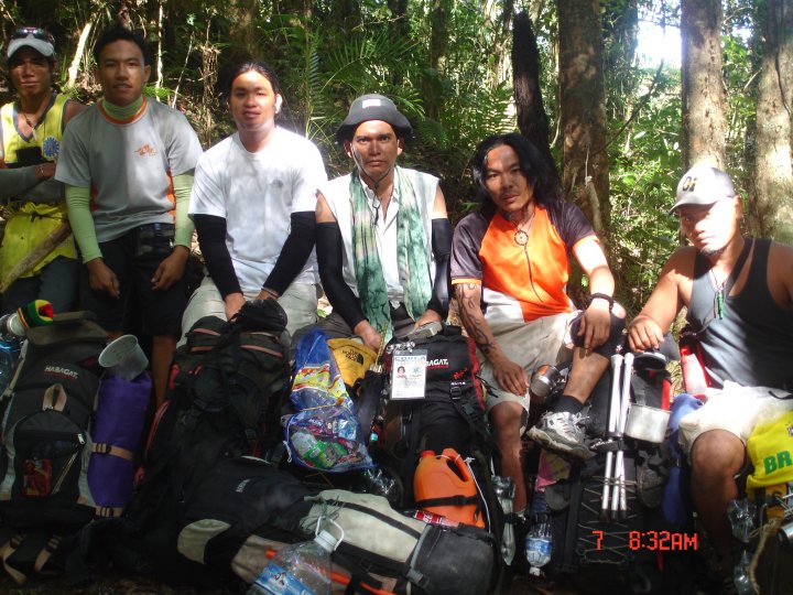
Days required / Hours to summit: 3-4 days / 15-16 hours Bonard James "Mayo" De La Rita
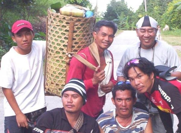
Specs: Major climb, Difficulty 8/9, Trail class 4 Romeo "Pudol" Odani, Porter
Romulo "Paksiw" Odani, Guide
BACKGROUND
The country's largest active volcano and Visayas' highest mountain is Mt. Kanlaon in Negros Island. As the highest mountain in the Visayas, it is majestic. As the country's largest active volcano, it is fearsome. Its majesty lies in its forests, waterfalls, lagoons, and culminates in its crater, vast and desolate. However, this seat of majesty is also the source of Mt. Kanlaon's volcanic wrath. It is, after all, one of the most active volcanoes in the Philippines. Its 1996 eruption killed 7 mountaineers - in an account vividly recalled to the blogger by Rey Castellos, the guide who rescued some of the foreign climbers and witnessed the eruption, barely making it alive. The blogger himself personally experienced this volcanic wrath when, on his climb to Mt. Kanlaon in February 9, 2008, Mt. Kanlaon spewed ash and stream - a phreatic eruption which obscured everything in the mountain. The ensuing rains and violent weather ultimately prevented him from reaching the summit.
The place that Mt. Kanlaon holds for the people of Negros is irreplaceable and important in many aspects of their life. Culturally, Kanlaon is central to the loyal mythology, named after no less than Kan Laon, the supreme deity. Some tribes also hold Kanlaon to be center of the universe - its crater a portal into the unknown source of fire and energy. Attesting to the plurality of legends the mountain has inspired, children also grew up to the tales of "La-on and the
Seven-Headed Dragon" . In this tale, a dragon appeared from the mountain, wreaking havoc in the whole island. In order to appease the dragon, the people had to sacrifice one beautiful maiden each year, until they have run out of women, save for the king's daughter. The King, agonized, offered a reward to anyone who could kill the dragon. Then comes a prince named La-on, whose affinity with nature and animals helped him slay the dragon - winning the princess' hand and
earning the mountain as a tribute for his feat, hence Kan Laon, meaning "The Exalted" Laon, later becoming Kanlaon.
Economically, the highland domain of Kanlaon is the source of vegetables and fruits in the same way that Benguet is the 'Salad Bowl' of Luzon. It provides a home for a lot of communities, who earn their livelihood from the forest products. Ecologically, Kanlaon is another biodiversity haven, home to about 197 species of flora and an impressive roster of fauna, such as the endangered Philippine spotted deer and the Visayan Warty Pig.
Of course, the geologic importance of Kanlaon attracts foreign tourists who want to see the country's third most active volcano (next to Mayon and Taal) in its volcanic glory. But also because of this danger, close coordination with DENR is a must when climbing the mountain.
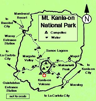
The most comprehensive trip to Kanlaon involves taking the Wasay and Masulog trails. The Wasay trail starts from the mountain resort of Mambucal, requiring two arduous days of trek just to reach the crater. Invariably, it has been compared to trekking in Mt. Halcon and is said
to be one of the most difficult and longest trails in the Visayas. The first day passes by dipterocarp forests, set in rolling slopes. The culmination of the seven-hour hike is Harding Sang Balo (Garden of the Widow), a campsite with a nearby water source. Here marks the transformation of the forest from the tall diperocarps to the montane variety.
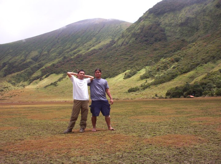
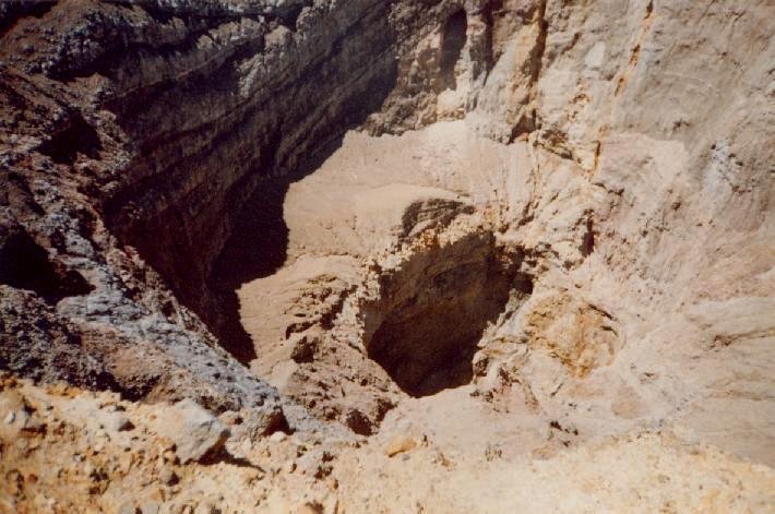
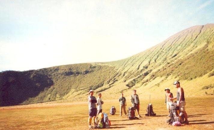
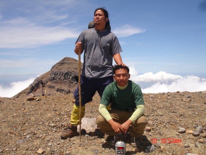
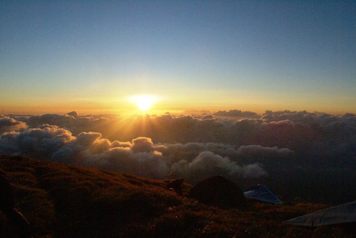
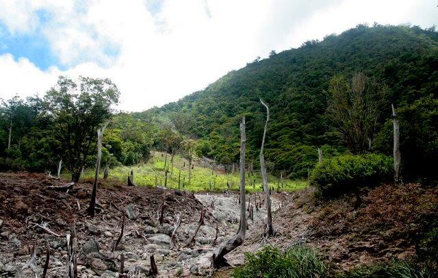
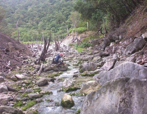
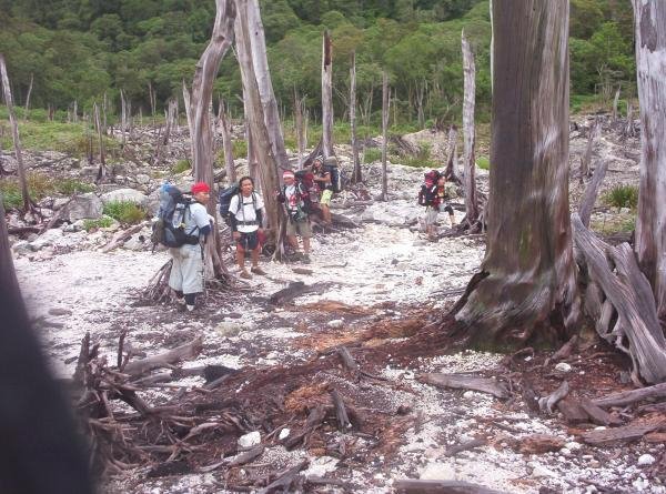
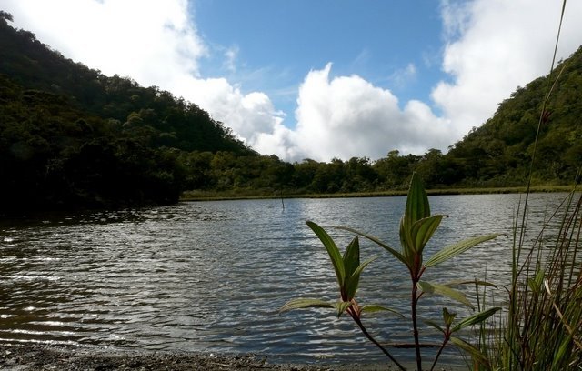
The next day is a feast for the eyes. Although a total of 164 different obstacles lie in wait on this most difficult leg of the journey, dubbed by local guides as the "Killing Me Softly" trail, there are beautiful sights such as the lagoons (Samoc lagoon, PMS lagoon). These lagoons are actually old craters of Kanlaon. The breathtaking Margaha Valley is next, and finally, after crossing the valley ridge, the cone-shaped summit-crater. Said to be the center of the universe in some myths, the crater of Kanlaon is vast and deep, devoid of vegetation and is comprised of pyroclastic material. There is a sense of fear and wonder in camping in the summit area - the volcano can erupt anytime.
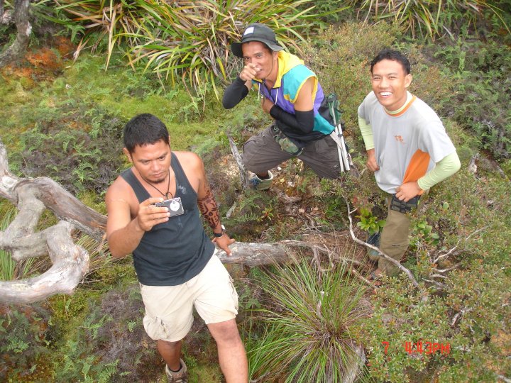
Until we arrived at Pagatpat Ridge, where this area is the camping site of the the climbers from the Guintubdan Trail route. We take our lunch in there. We already seen mountaineers from the different groups from La Carlota City which the group were very happy because in almost 3 days of the trek, we haven't seen girls yet heheheh. Wali shouted for joy, we go down to the vast area called Margaha Valley, we establish camp in there. We came along together with some local families of Masulog, Canlaon City, were they find some ingredients for their medicine at the Area in every Holy week of the year. Nong Noli Sarita shared his 7 sticks of cigarettes to the locals, 4 to them and 3 for him. We Camped and sleep in the area.
Climbing Mt. Kanlaon - the active volcano and the majestic mountain - is truly a profound experience that must not be missed in one's lifetime!
SPECIAL CONCERNS
The person to contact is Sir Angelo Bibar, the Park Superintendent of Mt. Kanlaon National Park (MKNP). Very kind and accommodating, he may be reached at +639173011410. Although checking the PHIVOLCS bulletin is prudent, the DENR is updated anyway and won't allow any climbs if there is an alert level hoisted. Thus DENR is the only institution to contact. They'll also be the ones to arrange the guides. Rate is P500/day for the guide exclusive of food and tent that you have to provide. Park fees cost P320 per person (P220 if student).
TRIVIA
The 1996 eruption of Mt. Kanlaon claimed the lives of 3 climbers: the rest had to be rescued by helicopters. It was a dramatic volcanic event, with ash being spewed 1.5 kilometers up in the air. Kanlaon is one of the the country's deadliest climbing destinations. One climber who fell on the Margaha Valley ridge had to eat tissue paper for seven days before being rescued! Truly one must exercise caution in climbing Kanlaon.
THE TRAILS OF MT. KANLAON
Mambucal (Wasay) - Guintubdan (Ara-al)
Canlaon City (Mapot) -Canlaon City (Masulog)
Negros Occidental Buddies:
Entry point: Brgy. Mambucal, Murcia, Negros Occ. Noli "Nukos" Sarita
Exit point: Masulog, Mananawin, Canlaon City, Negros Oriental Neil "Tanelz" Batohanon
LLA: 10°24'44"N, 123°7'55"E, 2435 MASL (#27) Walter "Wali" Caunca
Days required / Hours to summit: 3-4 days / 15-16 hours Bonard James "Mayo" De La Rita
Specs: Major climb, Difficulty 8/9, Trail class 4 Romeo "Pudol" Odani, Porter
Romulo "Paksiw" Odani, Guide
BACKGROUND
The country's largest active volcano and Visayas' highest mountain is Mt. Kanlaon in Negros Island. As the highest mountain in the Visayas, it is majestic. As the country's largest active volcano, it is fearsome. Its majesty lies in its forests, waterfalls, lagoons, and culminates in its crater, vast and desolate. However, this seat of majesty is also the source of Mt. Kanlaon's volcanic wrath. It is, after all, one of the most active volcanoes in the Philippines. Its 1996 eruption killed 7 mountaineers - in an account vividly recalled to the blogger by Rey Castellos, the guide who rescued some of the foreign climbers and witnessed the eruption, barely making it alive. The blogger himself personally experienced this volcanic wrath when, on his climb to Mt. Kanlaon in February 9, 2008, Mt. Kanlaon spewed ash and stream - a phreatic eruption which obscured everything in the mountain. The ensuing rains and violent weather ultimately prevented him from reaching the summit.
The place that Mt. Kanlaon holds for the people of Negros is irreplaceable and important in many aspects of their life. Culturally, Kanlaon is central to the loyal mythology, named after no less than Kan Laon, the supreme deity. Some tribes also hold Kanlaon to be center of the universe - its crater a portal into the unknown source of fire and energy. Attesting to the plurality of legends the mountain has inspired, children also grew up to the tales of "La-on and the
Seven-Headed Dragon" . In this tale, a dragon appeared from the mountain, wreaking havoc in the whole island. In order to appease the dragon, the people had to sacrifice one beautiful maiden each year, until they have run out of women, save for the king's daughter. The King, agonized, offered a reward to anyone who could kill the dragon. Then comes a prince named La-on, whose affinity with nature and animals helped him slay the dragon - winning the princess' hand and
earning the mountain as a tribute for his feat, hence Kan Laon, meaning "The Exalted" Laon, later becoming Kanlaon.
Economically, the highland domain of Kanlaon is the source of vegetables and fruits in the same way that Benguet is the 'Salad Bowl' of Luzon. It provides a home for a lot of communities, who earn their livelihood from the forest products. Ecologically, Kanlaon is another biodiversity haven, home to about 197 species of flora and an impressive roster of fauna, such as the endangered Philippine spotted deer and the Visayan Warty Pig.
Of course, the geologic importance of Kanlaon attracts foreign tourists who want to see the country's third most active volcano (next to Mayon and Taal) in its volcanic glory. But also because of this danger, close coordination with DENR is a must when climbing the mountain.
The most comprehensive trip to Kanlaon involves taking the Wasay and Masulog trails. The Wasay trail starts from the mountain resort of Mambucal, requiring two arduous days of trek just to reach the crater. Invariably, it has been compared to trekking in Mt. Halcon and is said
to be one of the most difficult and longest trails in the Visayas. The first day passes by dipterocarp forests, set in rolling slopes. The culmination of the seven-hour hike is Harding Sang Balo (Garden of the Widow), a campsite with a nearby water source. Here marks the transformation of the forest from the tall diperocarps to the montane variety.
The next day is a feast for the eyes. Although a total of 164 different obstacles lie in wait on this most difficult leg of the journey, dubbed by local guides as the "Killing Me Softly" trail, there are beautiful sights such as the lagoons (Samoc lagoon, PMS lagoon). These lagoons are actually old craters of Kanlaon. The breathtaking Margaha Valley is next, and finally, after crossing the valley ridge, the cone-shaped summit-crater. Said to be the center of the universe in some myths, the crater of Kanlaon is vast and deep, devoid of vegetation and is comprised of pyroclastic material. There is a sense of fear and wonder in camping in the summit area - the volcano can erupt anytime.
Until we arrived at Pagatpat Ridge, where this area is the camping site of the the climbers from the Guintubdan Trail route. We take our lunch in there. We already seen mountaineers from the different groups from La Carlota City which the group were very happy because in almost 3 days of the trek, we haven't seen girls yet heheheh. Wali shouted for joy, we go down to the vast area called Margaha Valley, we establish camp in there. We came along together with some local families of Masulog, Canlaon City, were they find some ingredients for their medicine at the Area in every Holy week of the year. Nong Noli Sarita shared his 7 sticks of cigarettes to the locals, 4 to them and 3 for him. We Camped and sleep in the area.
Climbing Mt. Kanlaon - the active volcano and the majestic mountain - is truly a profound experience that must not be missed in one's lifetime!
SPECIAL CONCERNS
The person to contact is Sir Angelo Bibar, the Park Superintendent of Mt. Kanlaon National Park (MKNP). Very kind and accommodating, he may be reached at +639173011410. Although checking the PHIVOLCS bulletin is prudent, the DENR is updated anyway and won't allow any climbs if there is an alert level hoisted. Thus DENR is the only institution to contact. They'll also be the ones to arrange the guides. Rate is P500/day for the guide exclusive of food and tent that you have to provide. Park fees cost P320 per person (P220 if student).
TRIVIA
The 1996 eruption of Mt. Kanlaon claimed the lives of 3 climbers: the rest had to be rescued by helicopters. It was a dramatic volcanic event, with ash being spewed 1.5 kilometers up in the air. Kanlaon is one of the the country's deadliest climbing destinations. One climber who fell on the Margaha Valley ridge had to eat tissue paper for seven days before being rescued! Truly one must exercise caution in climbing Kanlaon.
THE TRAILS OF MT. KANLAON
Mambucal (Wasay) - Guintubdan (Ara-al)
Canlaon City (Mapot) -Canlaon City (Masulog)

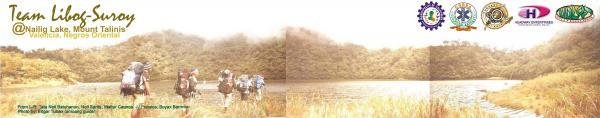
MT. TALINIS (APOLONG-BEDIAO TRAVERSE)
Dauin and Valencia City, Negros Oriental Buddies:
Entry point: Brgy. Apolong, Valencia City Raul "RoadBum" Bermeo
Exit point: Brgy. Bediao, Dauin Noli "Nokus" Sarita
LLA: 1903 MASL Walter "Wali" Caunca
Days required / Hours to summit: 2-3 days / 10-11 hours Neil "Tanelz" Batohanon
Specs: Major climb, Difficulty 6/9, Trail class 2-4 Edgar Tuban, Guide
Features: Lakes, waterfalls, mossy forest
BACKGROUND
A longtime favorite Visayan destination of mountaineers is Mt. Talinis in Southern Negros, otherwise known as "Cuernos de Negros" for the horn-like peaks that highlight the mountain. It holds its position as the second highest mountain in Negros, next only to the lofty Kanlaon.
It is not surprising that Talinis is the only mountain other than Mt. Apo to have become twice the venue of the annual MFPI Federation climbs, among other activities. Its only impediment is the perennial rumor of NPA presence, but as of 2009, it is perfectly safe to climb Talinis.
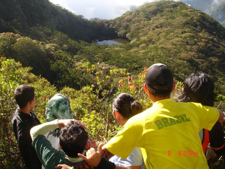
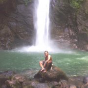
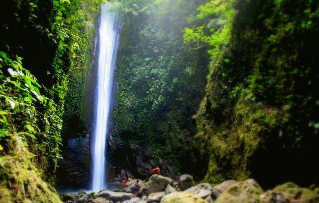
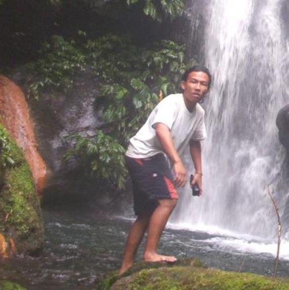
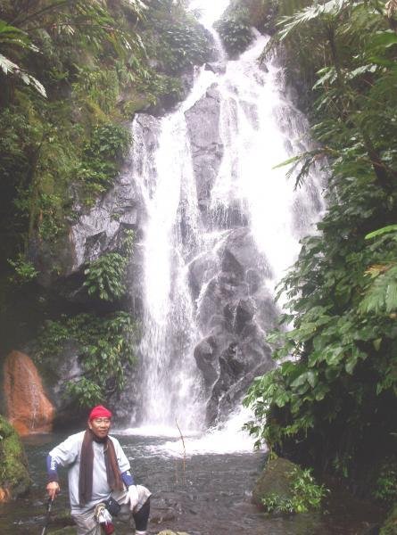
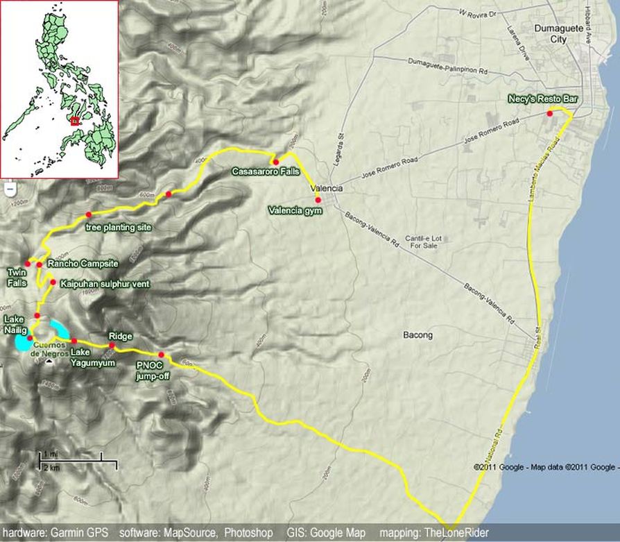
There are several trails but the most typical, and comprehensive enough, route is a traverse from the Bediao trail in Dauin, Negros Oriental, to Apolong. The roster of places to see is formidable: first is Lake Yagumyum with the optional ascent to Yagumyum Peak; then, passing by the mystical maribuhok forests, one reaches the higher and grander Lake Nailig. From this lagoon there is again the option to scale Nailig Peak, otherwise known as Talinis Dako i.e. the highest point in the mountain. Finally, on the way down via the Apolong Route, pass by the sulphuric river and the Twin Falls of Talinis before ending in the grand cascade of Casaroro Falls, the highest in Negros at over 90 meters. A destination by itself, Casaroro Falls is a fitting conclusion to the Talinis experience.
SPECIAL CONCERNS
Mt. Talinis is one of the remaining mountains under the care of a local mountaineering club, in keeping with old mountaineering tradition. TheCuernos de Negros Mountaineers, Inc. (CNMCI) based in Siliman University, Dumaguete, has maintained a close and fruitful relationship with the mountain and they are the best contact when planning a Talinis climb.
Transportation. To go to Talinis, the staging-off point is Dumaguete City. There are at least a few flights daily. Fares range from 3000-6000 roundtrip. Or, take the six-hour trip from Bacolod to Dumaguete (~P180). From Dumaguete take a tricycle to the Ceres bus terminal and take the minibus to Dauin. From Dauin municipality take a habal-habal up the mountain to the jumpoff in Bediao Geothermal Site. At the other end - you can take a habal-habal from the Casaroro Falls junction to Valencia town proper, where jeepneys will take you back to Dumaguete. Here don't fail to appreciate a nice view of Talinis.
Climbing notes. It is safe to swim on both lakes Yagumyum and Nailig although the latter is cleaner albeit colder. You can also swim in the pools of Casaroro Falls. Cellphone signal is sporadic on the trail but it is present in the Maribuhok-Nailig leg of the trail. Water sources are available in the two lakes as well.
TRIVIA
Beside Lake Nailig is another lake called Lake Mabilog. It has a pecuiliar rounded shape and is said to be the hideout of snakes.
Dauin and Valencia City, Negros Oriental Buddies:
Entry point: Brgy. Apolong, Valencia City Raul "RoadBum" Bermeo
Exit point: Brgy. Bediao, Dauin Noli "Nokus" Sarita
LLA: 1903 MASL Walter "Wali" Caunca
Days required / Hours to summit: 2-3 days / 10-11 hours Neil "Tanelz" Batohanon
Specs: Major climb, Difficulty 6/9, Trail class 2-4 Edgar Tuban, Guide
Features: Lakes, waterfalls, mossy forest
BACKGROUND
A longtime favorite Visayan destination of mountaineers is Mt. Talinis in Southern Negros, otherwise known as "Cuernos de Negros" for the horn-like peaks that highlight the mountain. It holds its position as the second highest mountain in Negros, next only to the lofty Kanlaon.
It is not surprising that Talinis is the only mountain other than Mt. Apo to have become twice the venue of the annual MFPI Federation climbs, among other activities. Its only impediment is the perennial rumor of NPA presence, but as of 2009, it is perfectly safe to climb Talinis.
There are several trails but the most typical, and comprehensive enough, route is a traverse from the Bediao trail in Dauin, Negros Oriental, to Apolong. The roster of places to see is formidable: first is Lake Yagumyum with the optional ascent to Yagumyum Peak; then, passing by the mystical maribuhok forests, one reaches the higher and grander Lake Nailig. From this lagoon there is again the option to scale Nailig Peak, otherwise known as Talinis Dako i.e. the highest point in the mountain. Finally, on the way down via the Apolong Route, pass by the sulphuric river and the Twin Falls of Talinis before ending in the grand cascade of Casaroro Falls, the highest in Negros at over 90 meters. A destination by itself, Casaroro Falls is a fitting conclusion to the Talinis experience.
SPECIAL CONCERNS
Mt. Talinis is one of the remaining mountains under the care of a local mountaineering club, in keeping with old mountaineering tradition. TheCuernos de Negros Mountaineers, Inc. (CNMCI) based in Siliman University, Dumaguete, has maintained a close and fruitful relationship with the mountain and they are the best contact when planning a Talinis climb.
Transportation. To go to Talinis, the staging-off point is Dumaguete City. There are at least a few flights daily. Fares range from 3000-6000 roundtrip. Or, take the six-hour trip from Bacolod to Dumaguete (~P180). From Dumaguete take a tricycle to the Ceres bus terminal and take the minibus to Dauin. From Dauin municipality take a habal-habal up the mountain to the jumpoff in Bediao Geothermal Site. At the other end - you can take a habal-habal from the Casaroro Falls junction to Valencia town proper, where jeepneys will take you back to Dumaguete. Here don't fail to appreciate a nice view of Talinis.
Climbing notes. It is safe to swim on both lakes Yagumyum and Nailig although the latter is cleaner albeit colder. You can also swim in the pools of Casaroro Falls. Cellphone signal is sporadic on the trail but it is present in the Maribuhok-Nailig leg of the trail. Water sources are available in the two lakes as well.
TRIVIA
Beside Lake Nailig is another lake called Lake Mabilog. It has a pecuiliar rounded shape and is said to be the hideout of snakes.


Planking @ Tops Mountains view of Boracay Island. background Boracay.
